Lab 4- Miscellaneous Image Functions

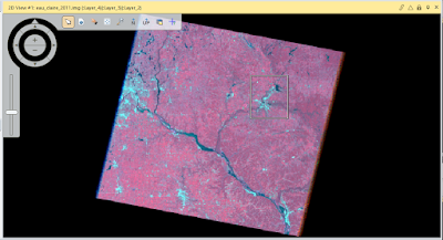
Goal and Background: The goal of this lab is learn multiple image functions through the use of ERDAS Imagine and multiple satellite images. The first goal is to extract specific study areas from larger satellite images, then demonstrate how spatial resolution of images can be optimized for visual interpretation purposes, utilize radiometric enhancement techniques in optical images, link satellite images to Google Earth, re-sample satellite images, utilize image mosaicking techniques, and use binary change detection through graphic modeling. Methods: Part 1: Image Subsetting Section 1: Inquire Box The first task was Image subsetting or creating an Area of Interest (AOI) through the use of an inquire box. This is a simple method of extracting a study area from a satellite image. This method requires placing the inquire box over the AOI and extracting that part of the image (Figure 1). After pl...