Posts

Lab 8 Spectral Signature analysis and Resource Monitoring

Image
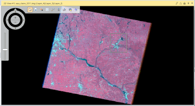
Lab 8 Spectral Signature analysis and Resource Monitoring Goal The main goal of this lab is to interpret spectral reflectance of various Earth surfaces and near the earths surface from satellite images, and to perform monitoring of surface features. In this lab we will collect spectral signatures from remotely sensed images, and create maps showing Different spectral signatures. Methods Part 1: Spectral Signature Analysis First spectral signatures were gathered by finding areas in the image that contained a surface feature we were looking for, and an area of interest was put in the area, and the spectral signature was recorded. This was done for 12 features some of them being Crops, Dry and Wet soil, standing water, moving water, and some more. Part 2: Resource Monitoring Section 1: Vegetation and Health Monitoring IN this section of part 2 vegetation was the focus, and a NDVI or normalized difference vegetation index was produced for Eau Claire and Chippewa Counties. This in...

Lab 7: Photogrammetry

Image
Lab 7: Photogrammetry Goal and Background The main goal of this lab is to develop skills in photogrammetric tasks on aerial photos and satellite images. Specifically the goal is to understand the mathematics behind calculating photographic scales, measuring areas and perimeters of features, and calculating relief displacement. In addition the lab is intended to introduce stereoscopy and performing orthorectification on satellite images. After the completion of this lab we will have the ability to perform diverse photogrammetric tasks. There are three parts to this lab: part 1-scales, measurements and relief displacement, part 2-stereoscopy, and part 3- orthorectification. Part 1, Section 1: Calculating scale of nearly vertical aerial photographs. Part 1, section 2: Measuring areas of features on a photograph. Part 1, section 3: Calculating relief displacement from object height. Part 2, Section 1: Created an anaglyph image with the use of a Digital Elevation Model (DEM). ...

Lab 6: Geometric Correction

Image
Lab 6: Geometric Correction Goal and Background The goal of this lab is to utilize geometric correction, which is the process of removing geometric distortion in imagery to put individual pixels in their proper planimetric position. Two types of Geometric correction will be performed on two different images. The first is an image-to-map rectification, which uses a map to correct a satellite image. The second is an image-to-image rectification. this uses an already corrected image to rectify an image that is distorted. These processes are part of preprocessing activities which are performed before biophysical and sociocultural information can be extracted from satellite images. Methods Part 1: Image-to-Map Rectification In the first part of this lab an image of the Chicago Illinois (Figure1) area was to be recorrected through the use of a topographic map (Figure 2) of the same area over the Chicago region of Illinois. This correction of the image was done using a First Ord...

Lab-5 LiDAR Remote Sensing

Image
Goal and Background The goal of this lab is to gain basic LiDAR skills through the use of ArcGIS. Some Specific goals were processing and retrieving surface and terrain models. The creation of an intensity image and other point cloud images. The LiDAR data used is in LAS file format which is easily manipulated through the use of ArcGIS. Methods Part 1: Point cloud visualization in Erdas Imagine The first part of this lab Erdas Imagine was used to input point clouds and visualize the LiDAR imagery. This was done by opening each individual LiDAR point cloud file in .las format and this gives the ability to view the LiDar image as a whole (Figure 1).  Figure 1: This image shows the importing process of LAS files into Erdas Imagine.  Next we brought these same files into ArcMap where it is easier to manipulate Lidar imagery. This was done by creating an LAS data file where LAS point cloud imagery was added of Eau Claire county. This data appears in a bunch of tile...

Lab 4- Miscellaneous Image Functions

Image
Goal and Background: The goal of this lab is learn multiple image functions through the use of ERDAS Imagine and multiple satellite images. The first goal is to extract specific study areas from larger satellite images, then demonstrate how spatial resolution of images can be optimized for visual interpretation purposes, utilize radiometric enhancement techniques in optical images, link satellite images to Google Earth, re-sample satellite images, utilize image mosaicking techniques, and use binary change detection through graphic modeling.  Methods: Part 1: Image Subsetting Section 1: Inquire Box             The first task was Image subsetting or creating an Area of Interest (AOI) through the use of an inquire box. This is a simple method of extracting a study area from a satellite image.  This method requires placing the inquire box over the AOI and extracting that part of the image (Figure 1). After pl...